 by
by Billings, Montana — A large and long-lasting winter storm system is sweeping across the northern and central United States this weekend, bringing widespread snow, blowing snow, and hazardous travel conditions from the northern Rockies to the Mid-Atlantic. The National Weather Service says the system’s sheer size and duration are the main concerns, with impacts expected to continue through Sunday and, in some areas, into early next week.
Major Winter Storm Impacts Stretch Coast to Coast
According to the National Weather Service, the storm spans more than a dozen states and is affecting travel during a busy weekend period. Forecasters note that “the primary concern is the storm’s longevity rather than extreme snowfall totals everywhere,” as steady snow and falling temperatures overlap with weekend travel, work shifts, and seasonal events.
Winter Weather Advisories are in effect across large portions of the northern High Plains, Midwest, Ohio Valley, and parts of the Northeast.
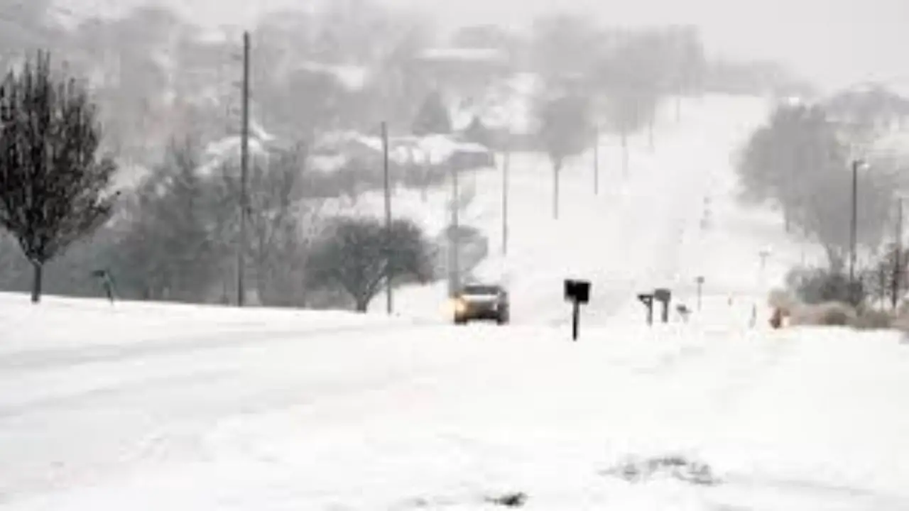
Snow Continues Across the Northern High Plains
Snow is ongoing Saturday across parts of Montana, North Dakota, and South Dakota. Forecasters expect accumulations generally between 1 and 5 inches, though blowing snow may sharply reduce visibility in open and rural areas.
In western Montana, the NWS warns of additional icing potential in higher elevations, particularly near Marias Pass, where “slick conditions could complicate mountain travel.” Drivers are urged to use caution on mountain routes and secondary highways.
Central Plains and Midwest See Steady Snowfall
As the system shifts east, Iowa, Nebraska, Missouri, and Illinois remain under widespread Winter Weather Advisories. Forecast guidance suggests 2 to 5 inches of snow across much of the region, with localized higher totals possible.
Meteorologists caution that “snowfall combined with falling temperatures may lead to rapidly deteriorating road conditions,” especially Saturday evening and overnight. Cold air trailing the system could push wind chills below zero in parts of Missouri and Iowa, increasing frostbite risk for prolonged outdoor exposure.
Snow Intensifies in the Ohio Valley
Snowfall is expected to intensify Saturday afternoon and evening across Indiana, Ohio, and Kentucky, continuing into early Sunday. Forecast totals vary widely, ranging from 1 to 6 inches depending on location.
Officials warn that even lighter accumulations could cause significant travel problems as snow sticks quickly to untreated roads, bridges, and elevated surfaces.
Heaviest Snow Expected in Appalachians and Western Pennsylvania
The most significant snowfall with this system is forecast across parts of West Virginia and western Pennsylvania. The National Weather Service reports that “3 to 10 inches of snow is possible,” with the highest totals likely in ridge communities.
Several NWS offices also note that lake-effect snow could prolong hazardous conditions into Monday, particularly across northern Ohio and western Pennsylvania, even after the main storm moves out.
Advisories Extend Into the Northeast
Farther east, parts of New Jersey, Delaware, and southeastern New York are under Winter Weather Advisories from late Saturday through Sunday. These areas are expected to receive 2 to 4 inches of snow, enough to create slick travel conditions, especially overnight and during early morning hours.
Conclusion
While snowfall totals vary by region, forecasters emphasize that the storm’s broad reach increases the likelihood of travel disruptions across much of the country. Transportation agencies are preparing for slick highways, reduced visibility, and possible delays as the system continues eastward.
How much snow are you seeing where you live, and how are road conditions in your area? Share your local update in the comments below.