 by
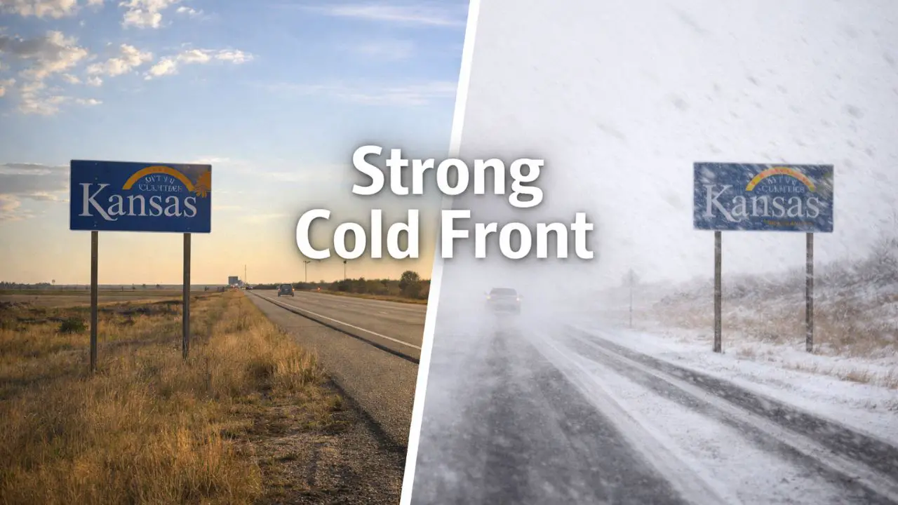
by Wichita, Kansas — A stretch of unseasonably mild December weather is coming to a swift end across Kansas. While conditions remain relatively calm early, a powerful cold front is poised to sweep through the state on Sunday, delivering strong north winds, a sudden temperature plunge, and much colder air that will linger into early next week.
Forecasters say the shift will be noticeable and fast, marking a clear return to winter after several days of deceptive warmth.
Strong Cold Front Moves Through Sunday
According to the National Weather Service office in Wichita, the cold front is expected to cross Kansas on Sunday, replacing mild air with a much colder and windier pattern.
Behind the front, gusty north winds will develop, driving daytime highs down into the 35 to 50 degree range, depending on location. That represents a 15 to 25 degree drop compared to recent afternoon temperatures.
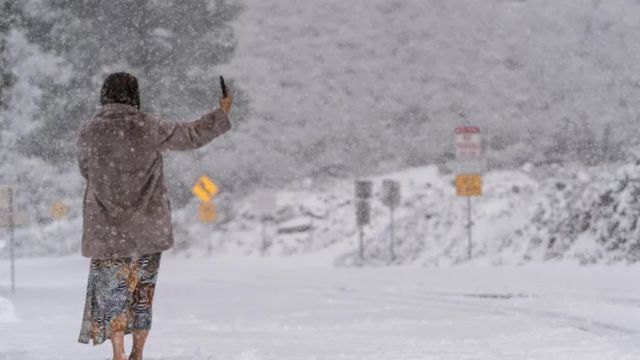
The coldest air settles in Sunday night, when wind chills fall into the teens, especially across central and southeast Kansas by early Monday morning.
Showers Possible Before the Front
The transition may not be entirely dry. Parts of southern and southeast Kansas could see scattered rain showers or a few isolated storms late Saturday night into early Sunday, just ahead of the advancing front.
Rain chances remain limited, but even brief showers could create slick pavement, especially as winds increase. Early-morning travelers should be prepared for rapidly changing road conditions.
Wind Becomes a Major Factor Sunday Afternoon
By Sunday afternoon, conditions turn brisk statewide. Cities including Wichita, Hutchinson, Salina, and Great Bend will feel the impact as temperatures tumble and winds intensify.
North winds may gust high enough to make it feel significantly colder than the actual air temperature. Crosswinds could affect travel along I-35, I-135, and Highway 54, particularly for high-profile vehicles such as trucks, vans, and RVs.
Read Also: Illinois Holiday Weather: Low Visibility Now, Rain Friday, Freeze Next
Loose outdoor items may be blown around, and residents are encouraged to secure decorations, trash bins, and lightweight furniture before winds peak.
Coldest Conditions Arrive Monday Morning
Monday brings the sharpest cold of the period. Morning lows drop into the mid to upper teens, with afternoon highs struggling to reach near 30 to mid-30s.
The combination of cold temperatures and lingering breezes will make the morning commute feel especially harsh. Residents should bundle up, limit prolonged outdoor exposure, and take steps to protect pets, sensitive plants, and exposed pipes from freezing conditions.
Gradual Warm-Up Midweek
Temperatures begin a slow recovery by midweek. Forecasts call for highs rebounding into the 40s and low 50s by Tuesday and Wednesday, accompanied by lighter winds and quieter weather.
While the moderation offers some relief, meteorologists say winter patterns appear re-established heading into the final days of December, suggesting colder air will remain nearby.
What Kansans Should Prepare For
- Sunday: Sharp temperature drop and strong north winds
- Late Saturday night: Spotty showers possible in southern areas
- Sunday afternoon: Gusty winds and brisk travel conditions
- Monday morning: Wind chills in the teens, coldest air arrives
The holiday calm is giving way to a classic winter reset across Kansas. Staying weather-aware and preparing for the sudden change will help minimize impacts as colder air settles in.
Are you feeling the temperature shift already where you live? Share your local conditions and travel plans in the comments below.