 by
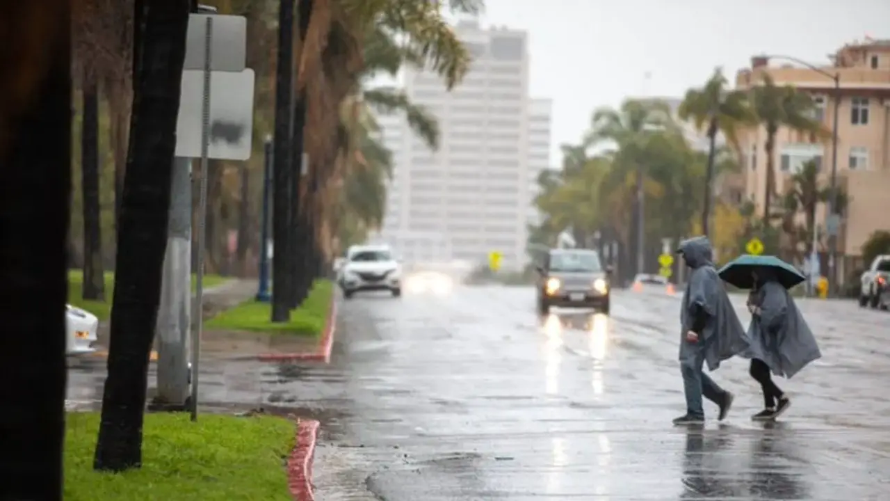
by San Diego County, California — A lingering wet weather pattern will keep intermittent light showers in the forecast across San Diego County through the weekend, with another round of heavier rain possible Saturday night into Sunday, according to forecasters. While rainfall totals are not expected to match the intense New Year’s Day storm, officials say residents should remain alert for localized flooding, gusty winds, and coastal impacts tied to King Tides.
Meteorologists with the National Weather Service say several weak storm systems will move through the region in waves, keeping conditions unsettled into early next week before drier and warmer weather arrives later.
Wet pattern develops with multiple waves of rain
Forecasters say the region will experience several rounds of light, off-and-on showers, rather than one continuous storm.
“We’re going to have several waves of pretty light showers moving through,” said Chandler Price, a forecaster with the National Weather Service.
“One wave is expected late tonight or early Saturday morning, followed by a brief break during the day. Another wave of rain is expected Saturday night and could linger through Sunday.”
This pattern is expected to persist into Monday, with additional chances for showers across the county through Thursday, according to the NWS.
Saturday forecast: cloudy with scattered showers
Saturday will bring mostly cloudy skies across coastal, valley, and foothill communities.
Along the coast, highs are expected to range between 65 and 68 degrees, with southerly winds around 10 mph becoming lighter in the evening. Forecasters say there is a 50% chance of rain, mainly during the afternoon and evening hours.
In the valleys, highs will range from 66 to 69 degrees in western valleys, and 62 to 67 degrees near the foothills, with a slight chance of showers developing during the afternoon.
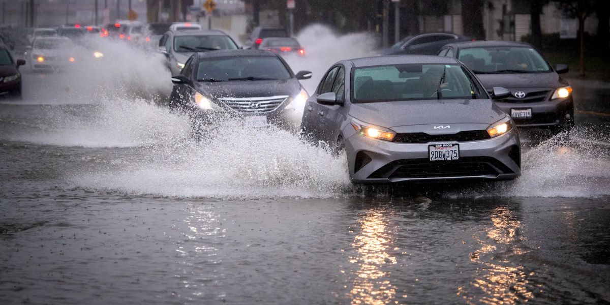
Rainfall amounts on Saturday are expected to remain light, but damp roadways and reduced visibility could still impact travel.
Sunday brings higher rain chances and thunder risk
Rain chances increase on Sunday, especially during the evening and overnight hours.
Coastal areas are forecast to remain mostly cloudy, with highs between 64 and 68 degrees. Showers are expected at times during the day, with locally heavier rainfall possible Sunday night.
Forecasters also note a slight chance of thunderstorms Sunday night, which could briefly intensify rainfall in some locations. Overnight lows along the coast will range from 51 to 55 degrees.
Read Also: Two New Speed Cameras Go Live in Baltimore City School Zones Starting January 5
Valley areas will see highs of 65 to 68 degrees in western valleys, and 60 to 65 degrees near the foothills, with similar chances for showers and isolated thunderstorms overnight.
King Tides raise coastal flooding concerns
In addition to rainfall, coastal areas will be dealing with King Tides, which can amplify flooding risks even with moderate rain.
“There is a beach hazard warning for minor coastal flooding in low-lying, flood-prone areas,” Price said.
“High King Tides are expected to peak at 6 to 7 feet through the weekend and end Monday morning.”
The NWS has issued a Beach Hazard Statement through Sunday, warning that high tides could lead to minor coastal flooding, especially near beaches, harbors, and low-lying shoreline roads.
Officials urge residents to avoid flooded areas and be cautious during high tide cycles.
New Year’s Day storm already saturated the region
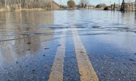
The latest round of showers comes on the heels of a historic New Year’s Day storm, which dumped a month’s worth of rain on parts of San Diego County in just hours.
According to Greg Bledsoe, more than two inches of rain fell at San Diego International Airport between midnight and early Thursday afternoon — exceeding the average rainfall for the entire month of January, which typically sits just under two inches.
“It’ll finish as one of the top 15 rainiest days ever in San Diego history, dating back to the 1930s,” Bledsoe said.
The rapid rainfall overwhelmed drainage systems, leading to flooding in Mission Valley, Fashion Valley, Mission Hills, and other low-lying areas across the county.
What to expect next week
Forecasters say the unsettled pattern will continue with periodic shower chances through Thursday, though rainfall amounts are expected to be lighter than recent storms.
By late next week, models suggest drier and warmer weather will return, offering a break from the active pattern that has dominated early January.
Key takeaways for residents
- Intermittent light showers continue through the weekend
- Heavier rain possible Saturday night into Sunday
- King Tides may cause minor coastal flooding
- Thunderstorms possible Sunday night
- Wet pattern may linger into midweek, then dry out
Residents are encouraged to stay weather-aware, especially in flood-prone and coastal areas, as even light rain can cause issues when combined with saturated ground and high tides.
Have you noticed flooding or high tides where you live in San Diego County? How did the New Year’s Day storm impact your area? Share your experience in the comments and join the conversation.