MJP –
A powerful storm system is set to impact Oklahoma and northern Texas tonight through Monday morning, with severe weather expected to intensify.
Strong winds, tornadoes, and heavy rainfall are all on the table. As the system sweeps in from northern Mexico, the likelihood of damaging winds and possible tornadoes increases.
A Flood Watch is in effect, with 1-3 inches of rain expected, heightening the risk of flooding. Strong winds of 40-50 mph will also make conditions dangerous, particularly through early afternoon on Monday. Stay alert for rapidly changing weather conditions, and take precautions to stay safe, the NWS advised the public.
Severe weather is set to make its way across Oklahoma and Texas in the coming days, bringing the threat of tornadoes, damaging winds, and large hail. The National Weather Service (NWS) has issued alerts for both states, warning residents to prepare for dangerous conditions as powerful storms are expected to develop and sweep through the region, with the greatest threat occurring late this week.
What to Expect: Tornadoes and Damaging Winds
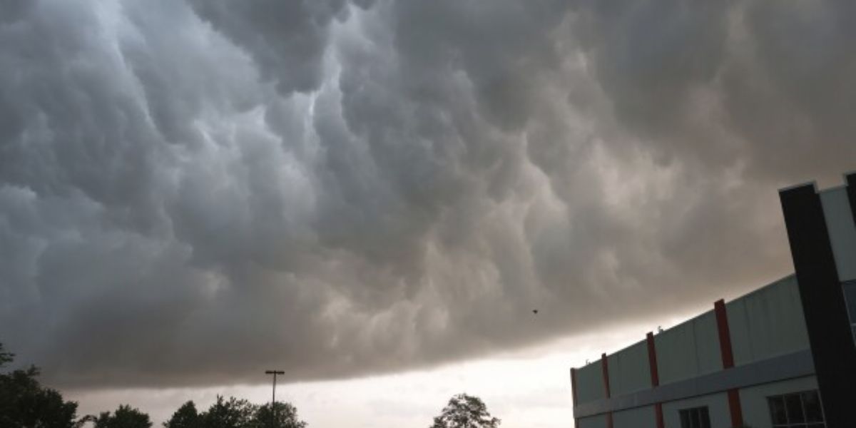
The storm system, expected to intensify late Thursday and into Friday, is forecast to bring a range of hazardous conditions. Severe thunderstorms will develop as a cold front collides with warm, moist air from the Gulf of Mexico, creating ideal conditions for tornadoes and high winds.

Residents of central Oklahoma, north Texas, and the Texas Panhandle are particularly at risk, as this region will see the highest likelihood of severe weather. Oklahoma City, Tulsa, Dallas, and Lubbock are among the areas that may experience the worst of the storms. The main threats from these storms include:
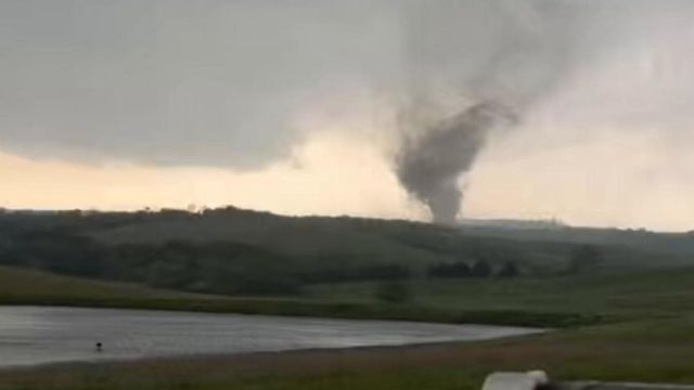
- Tornadoes: The potential for tornadoes to develop is high, especially in the afternoon and evening hours. These storms are expected to produce rotating updrafts capable of spawning EF1 to EF2 tornadoes, though stronger tornadoes (EF3+) are not out of the question.
- Damaging Winds: Strong straight-line winds are expected, with gusts up to 70 mph in some areas. These winds could cause significant damage to trees, power lines, and buildings, as well as create dangerous driving conditions.
- Large Hail: Some of the storms could produce hailstones as large as 2 inches in diameter, which can damage roofs, windows, and vehicles.
Timeline and Impact
Texas Panhandle Weather Warning: Freezing Rain and Heavy Downpours Expected
The storms are likely to begin in the late afternoon on Thursday, moving eastward throughout the evening and into the night. The peak time for severe weather is expected to be Thursday evening through Friday morning, with the threat of tornadoes and damaging winds lingering into the early hours of Friday.
Heavy rain is also a concern, with localized flash flooding possible, particularly in areas that receive prolonged downpours. 1–3 inches of rain could accumulate in some locations, worsening the flooding risk and making travel hazardous.
By Friday afternoon, the worst of the storms should begin to move out of Oklahoma and Texas, though isolated severe thunderstorms may continue in some areas through the day.
Areas at Greatest Risk
While the entire Oklahoma and Texas regions are under heightened watch, some areas are particularly vulnerable:
- Oklahoma City and Tulsa: These cities are at the core of the risk zone, where the threat of tornadoes and damaging winds will be most pronounced.
- Dallas/Fort Worth Metroplex: The DFW area will see high winds and the possibility of hail, with flash flooding posing an additional risk.
- Texas Panhandle: This area will likely experience the earliest storms, with tornadoes and high winds expected by Thursday evening.
- North Texas and Southern Oklahoma: Areas like Wichita Falls, Ardmore, and Norman will face a tornado watch as the conditions become favorable for storm development.
Safety Tips for Severe Weather
With the significant risks posed by the upcoming storms, it’s crucial for Oklahoma and Texas residents to stay prepared and stay safe. Here are some tips for coping with the storms:
- Stay informed: Keep up with weather alerts and warnings from the National Weather Service and local authorities. A weather radio, smartphone app, or TV can help you get the latest updates.
- Have an emergency kit: Prepare an emergency kit with essentials such as flashlights, batteries, medications, water, and non-perishable food. If you live in a tornado-prone area, consider keeping a battery-powered radio to stay informed if the power goes out.
- Know your safe place: If a tornado warning is issued, seek shelter immediately in a basement, storm cellar, or interior room on the lowest level of your home. Stay away from windows and cover yourself with a mattress or heavy blankets if possible.
- Avoid driving: If possible, stay off the roads during the storm. Flooded roadways, downed trees, and debris will make driving extremely dangerous. If you must drive, reduce speed and stay alert for road hazards.
- Prepare for power outages: The combination of high winds, tornadoes, and hail could lead to power outages across the region. Charge your cell phones and keep extra blankets and warm clothing in case of an extended outage.
- Follow evacuation orders: If you live in a flood-prone area or in a location that may be directly impacted by a tornado, follow any evacuation orders issued by local authorities.
Tornado Preparedness: What to Do If a Tornado Threatens
When a tornado warning is issued, you may have just a few minutes to take action. Keep the following steps in mind:
- Move to the lowest level of your home, preferably a basement or storm cellar. If you do not have a basement, take shelter in an interior room or closet with no windows, such as a bathroom or hallway.
- Cover your head with a heavy blanket, mattress, or any sturdy object that can protect you from flying debris.
- Do not seek shelter under a bridge or overpass; these can actually be more dangerous during a tornado.
- Stay in shelter until local authorities declare it is safe to emerge.
Conclusion
The upcoming storm system poses a significant threat to Oklahoma and Texas, with tornadoes, damaging winds, and heavy rainfall all expected to make for dangerous conditions. Residents are urged to take severe weather warnings seriously, make preparations now, and stay alert as the storm system develops.
By remaining informed, taking safety precautions, and knowing where to go if a tornado strikes, Oklahoma and Texas residents can minimize the risks and stay safe during this turbulent weather event.


