 by
by Severe weather threats are intensifying across the Midwest as the tornado risk in Illinois, particularly in South Chicago, has now expanded into Michigan. The National Weather Service (NWS) has issued warnings for strong winds, heavy rain, and the possibility of tornadoes forming in the region. Residents in these areas are urged to stay alert and take necessary precautions as the storm system moves through.
Severe Weather Warnings Issued
Meteorologists are closely monitoring the developing storm system, which has already triggered tornado watches and warnings across parts of Illinois. Now, with changing weather patterns, the risk has expanded into neighbouring Michigan, increasing concerns for communities in its path.
According to the NWS, the storm system has the potential for damaging winds reaching up to 70 mph, hail, and tornadoes. Forecasters say that areas from South Chicago to parts of Indiana and Michigan could experience rapid storm development, making preparedness essential.
Why Is This Storm System Dangerous?
The Midwest is no stranger to severe weather, but this particular system is raising alarms due to its rapid intensity and widespread impact. Key factors contributing to the danger include:
- High Wind Speeds: Gusts exceeding 70 mph can cause structural damage, topple trees, and create dangerous travel conditions.
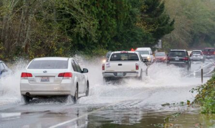
- Heavy Rainfall raises flooding risks, especially in urban areas where drainage systems may struggle to keep up.
- Tornado Development: Rotational activity in the storm system increases the likelihood of tornadoes forming with little warning.
- Hailstorm Possibility: The storm may bring hail as large as golf balls, capable of damaging vehicles, homes, and power lines.
Areas Most at Risk
The primary areas of concern include:
- Illinois: Especially South Chicago and surrounding counties.
- Indiana: Northwestern areas near the Illinois border.
- Michigan: The southwestern region, where the storm is expected to move next.
- Ohio: While not under immediate threat, severe weather conditions could extend into the state if the storm system strengthens further.
Forecasters stress that even areas outside the direct tornado warning zones should remain cautious, as severe storms can form and shift unpredictably.
How to Stay Safe During a Tornado Warning
With the increased risk of tornadoes, residents should take these safety steps:
- Stay Informed: Keep track of local weather updates via TV, radio, or mobile alerts.
- Identify a Safe Shelter: Find an interior room or basement away from windows.
- Prepare an Emergency Kit: Include essentials like water, food, flashlights, and first aid supplies.
- Avoid Travel: If possible, stay indoors and avoid driving through storm-affected areas.
- Follow Local Authorities’ Instructions: Evacuation orders or emergency instructions should be followed immediately.
- Secure Loose Objects: Bring in outdoor furniture, garbage cans, and any items that could become airborne in strong winds.
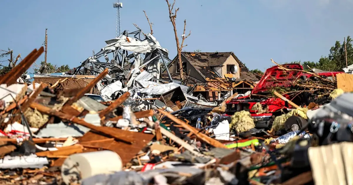
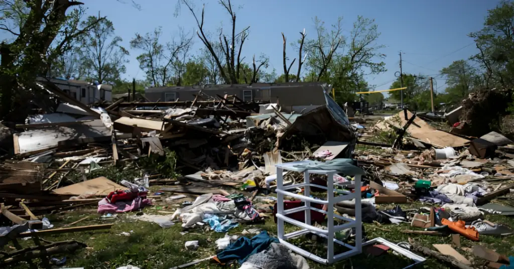
Impact on Communities and Infrastructure
As the storm system intensifies, significant disruptions are expected across affected states. Key concerns include:
- Power Outages: High winds and downed trees may lead to widespread blackouts, with utility companies warning of extended repair times if infrastructure is heavily damaged.
- Transportation Disruptions: Fallen debris and flash flooding could cause delays or closures on major highways, including I-90 and I-94.
- Business and School Closures: Schools and businesses may shut down as a precaution, especially in high-risk tornado zones.
- Emergency Services Strain: First responders and hospitals could experience an influx of storm-related injuries, requiring additional resources.
How Authorities Are Responding
Local and state emergency agencies are preparing for rapid response efforts in case of storm damage. The National Guard has been placed on standby in some areas, and evacuation shelters are being prepared to assist displaced residents.
Meteorologists emphasize the importance of preparedness, as tornadoes can develop quickly with minimal warning. Communities are encouraged to stay connected with emergency broadcasts and take any alerts seriously.
Expected Duration of the Storm
The severe weather conditions are expected to persist for the next 24 to 48 hours, with storms gradually weakening as they move eastward. However, meteorologists warn that some areas could experience prolonged effects if secondary storm cells form in the aftermath.
Officials are advising residents to remain cautious even after the immediate threat appears to have passed, as post-storm hazards such as flooding and downed power lines can still pose dangers.
Final Precautionary Measures
Residents in the affected regions should act now to prepare for worsening weather. Charging mobile devices, securing outdoor objects, and reviewing emergency plans with family members are all critical steps to ensure safety.
Authorities advise keeping an eye on official weather updates and remaining indoors when conditions deteriorate. The next few hours will be crucial in determining the full impact of this storm.
Disclaimer: This article has been meticulously fact-checked by our team to ensure accuracy and uphold transparency. We strive to deliver trustworthy and dependable content to our readers.