 by
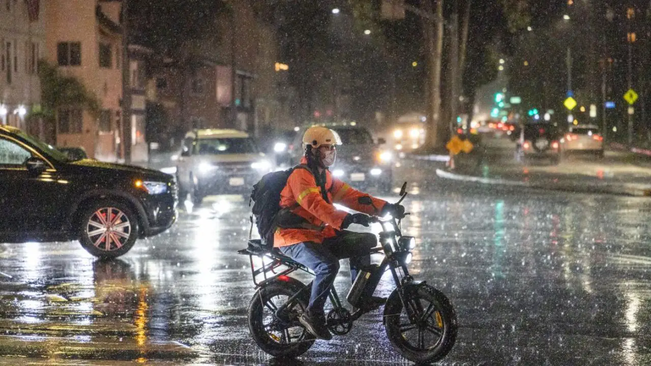
by Los Angeles, CA – Los Angeles County faced a sharp and potentially hazardous shift in weather on Monday as a colder Pacific storm system swept into the region, delivering heavier rain than expected, widespread thunderstorms and escalating concerns about flooding and debris flows, according to the National Weather Service (NWS).
Forecasters say the system will remain active through Tuesday, continuing to generate rapidly changing and locally dangerous conditions across Southern California.
The NWS reported that most areas of Los Angeles County can expect 1 to 2 inches of rainfall, with up to 3 inches likely in the Santa Ynez Range. Colder air trailing behind the storm will lower snow levels overnight, bringing up to 3 inches of snowfall above 6,000 feet and the possibility of light snow down to 4,500 feet, though little accumulation is expected.
Hazards Increase After Days of Rain
After several days of steady precipitation, soil saturation has reached levels that significantly increase the risks of flooding and geologic hazards. Local officials warn that even moderate showers are now capable of producing flooded roads, rising creeks, mudslides, rockslides and small debris flows, particularly in areas recently burned by wildfires.
“Conditions may deteriorate quickly, especially near burn scars and canyon roads,”
the National Weather Service cautioned in its latest advisory.
Residents are being urged to follow guidance from local authorities, avoid canyon routes during heavy rain bursts and monitor real-time roadway conditions before traveling.
Timing of Heaviest Rainfall
Forecasters expect the heaviest band of rainfall to move through Los Angeles County between 3 p.m. and 7 p.m., bringing the highest potential for localized flash flooding.
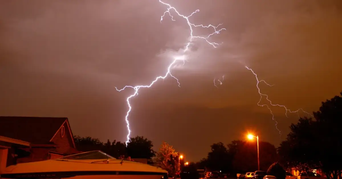
Meteorologists in the NWS Oxnard office noted that “convective storms” embedded within the system could bring strong, potentially damaging winds, lightning, small hail and isolated waterspouts along the coast.
These quick-forming thunderstorms may also produce intense but short-lived downpours capable of overwhelming storm drains and generating fast-moving debris flows on steep terrain.
Road Closures and Travel Disruptions
As rainfall intensified Monday, Caltrans announced that Topanga Canyon Boulevard (State Route 27) would remain closed from Pacific Coast Highway to Grand View Drive through Monday night.
The 3.6-mile stretch sits below saturated hillsides made unstable by last winter’s storms and the Palisades Fire, leaving the area especially vulnerable to mud or debris movement.
Read Also: Thunderstorms Expected as Cold Front Moves Into Houston This Week
Caltrans urged drivers to check Caltrans QuickMap for live updates on closures, traffic conditions and weather-related advisories through the evening.
The agency warned that additional closures could occur with little notice if storm conditions worsen.
Thunderstorm and Wind Threat Continues
As convective bands continue to develop offshore, meteorologists say the county could see periods of lightning, gusty winds, brief hail showers and a slight chance of a weak tornado, particularly along coastal and valley areas.
Wind gusts from these storm cells could reach speeds capable of downing small branches or causing isolated power outages.
The NWS recommends that residents secure outdoor items, avoid open areas during lightning activity and stay off the roads during the most intense bursts of rainfall.
The agency also noted that rapidly forming storm cells may not appear on radar until they are close to shore, making situational awareness essential.
Continued Alerts Into Tuesday
Officials expect elevated hazards to remain in place into Tuesday morning, even as overall rainfall begins to taper off.
Flooded intersections, small stream overflows, rockslides on canyon roads and debris on mountain highways will remain possible as saturated terrain continues to shift.
Public safety officials stressed that Southern California residents—especially those in foothill, canyon and burn-scar areas—should remain prepared for sudden changes in weather conditions.
Stay Informed
Los Angeles officials are encouraging residents to monitor alerts from local agencies, sign up for weather notifications and avoid unnecessary travel during peak storm hours.
With back-to-back winter systems already affecting the region, emergency planners say proactive caution will be essential in preventing accidents and avoiding dangerous conditions.
For more community updates and local coverage, visit mikeandjonpodcast.com.