 by
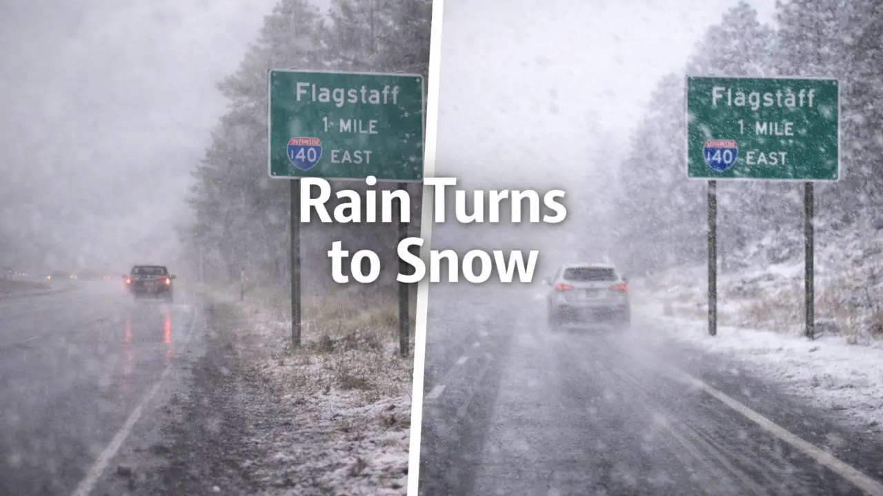
by Flagstaff, Arizona — Low clouds hang over the ponderosa pines this morning as damp pavement and steady southwest winds greet drivers across the high country. What begins as a gray, wet stretch of post-Christmas weather is expected to shift quickly toward winter conditions, with rain transitioning to snow and colder air tightening its grip through the weekend.
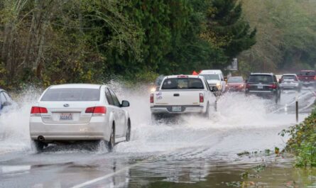
Travelers moving through northern Arizona should prepare for changing road conditions, especially during evening and overnight hours when temperatures fall fast.
Rain and Fog Start the Period
Periods of rain dominate early, lingering through the morning and into midday. Visibility may drop at times due to fog and low cloud cover, particularly in higher terrain around Flagstaff. Daytime highs climb into the upper 40s, but the mild feel fades quickly once daylight wanes.
Roads remain mostly wet through the day, though cooler air moving in after sunset sets the stage for potential slick spots overnight as temperatures dip toward freezing.
Friday Brings a Rain-to-Snow Transition
Friday introduces the first meaningful transition. Rain showers may mix with snow during the morning hours, especially in higher elevations and shaded areas. While daytime accumulation is expected to be minimal, drivers along I-40 and Highway 89 should stay alert for slick patches, particularly on bridges and less-traveled stretches.
Gusty winds increase the chill, making conditions feel colder than the thermometer suggests. Even where snow does not accumulate, wet roads combined with falling temperatures can quickly become hazardous after dark.
Saturday Delivers the Most Impact
Saturday appears to be the most impactful day of the period. Colder air deepens across northern Arizona, and rain is likely to change over to snow as the day progresses. Snow showers become more widespread by afternoon, with daytime highs holding near 43 degrees.
While forecast snowfall totals remain on the lighter side, even minor accumulation can significantly affect travel. Reduced traction and visibility are likely during snow showers, especially during the busy Saturday evening travel window.
Those planning trips through Flagstaff or across nearby mountain routes should allow extra time and expect slower conditions, particularly after sunset.
Cold Saturday Night Raises Ice Concerns
Saturday night turns sharply colder. Lows fall to around 21 degrees, allowing any lingering moisture to freeze. Snow showers gradually taper, but black ice becomes a concern, especially on untreated roads, shaded curves, and elevated surfaces.
Road crews may be active overnight, yet isolated slick spots can persist into early Sunday, even where pavement appears dry.
Sunday Remains Wintry but Calmer
Sunday brings some stabilization, though winter conditions linger. Skies stay mostly cloudy with a lingering chance of snow showers, and highs reach near 40 degrees. While conditions improve compared to Saturday, roads may remain slick in the morning before gradual improvement later in the day.
By Sunday night, skies begin to quiet, but temperatures plunge into the teens, reinforcing winter’s hold across the high country and setting up another cold start to the new week.
Read Also: Illinois Holiday Weather: Low Visibility Now, Rain Friday, Freeze Next
Travel and Safety Considerations
Meteorologists continue monitoring small shifts in storm timing that could influence snow coverage and impacts. Even minor changes in temperature can make the difference between wet pavement and icy roads in Flagstaff’s elevation.
Drivers are encouraged to:
- Keep winter gear accessible
- Check road conditions frequently
- Plan flexible travel windows
- Use caution after sunset when temperatures drop fastest
Post-holiday travel across northern Arizona often brings surprises, and this weekend is shaping up to be no exception.
Have you already noticed changing conditions or slick roads near Flagstaff? Share what you’re seeing or how you’re adjusting your travel plans in the comments below.