CAPE HATTERAS, N.C. – An intensifying low-pressure system off the Carolina coast on Friday is set to bring substantial effects to the Outer Banks, including damaging wind gusts, moderate to major coastal flooding, and heavy rainfall.
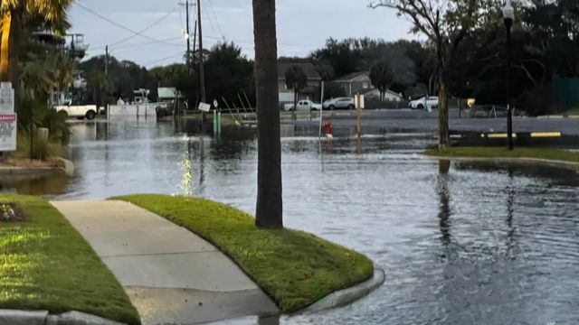
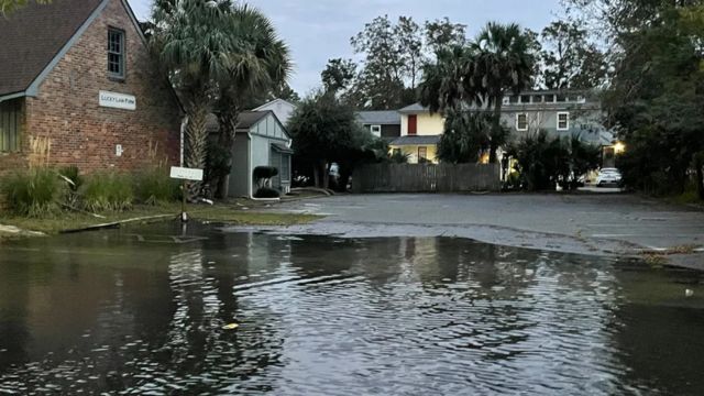
As the storm began to intensify, effects began to manifest Thursday morning along the South Carolina coastline, with a Coastal Flood Warning issued for Charleston and Colleton counties.
The local office in Charleston reported that tide levels at the Charleston Harbor gauge reached a significant high of 8.08 feet, while the Ft. Pulaski gauge recorded a moderate level of 10.25 feet.
Several roadways in downtown Charleston have been closed by the City Police due to significant saltwater flooding.
On Thursday, Mount Pleasant, South Carolina, may experience coastal flooding due to high tides affecting low-lying regions.
Cape Hatteras National Seashore in North Carolina is alerting visitors to hazardous conditions stemming from the low-pressure system. Expect strong winds, high surf, and coastal flooding to persist until Saturday. The beaches from Rodanthe to Buxton are currently closed because of hazards from debris. All campgrounds are accessible, though there may be a risk of flooding in lower regions.
A Storm Watch has been announced for a significant portion of coastal North Carolina.
In light of the impending northerly winds reaching speeds of 55 mph and hazardous sea conditions, a Storm Watch has been announced by the National Weather Service for a significant portion of coastal North Carolina. This alert will remain active from Thursday evening through at least Friday.
Anticipated precipitation levels for areas like Raleigh and Greensboro are projected to be fairly limited, approximately one to two inches. However, coastal regions may see significantly higher totals, which, coupled with rising sea levels, could result in flooding.
“Boaters in the Carolinas are advised to stay in port, change course, and/or secure their vessels for impending severe conditions,” cautioned meteorologists from the NWS.
According to the latest projections, coastal inundation levels ranging from 2 to 4 feet may affect the Outer Banks, potentially causing overwash on Highway 12 and further complications with erosion.

This year has seen four vacant houses fall into the Atlantic Ocean, with several others teetering on the brink of a similar fate.
Often, during major weather occurrences, sections of the beaches near Rodanthe and Buxton are shut down because of dangerous debris.
Choppy waves can shift pipes, and wires, and reveal concrete, posing risks for those at the beach and on the water.
The North Carolina Department of Transportation keeps a close eye on the roadways in the Outer Banks and sometimes shuts down the main route when necessary conditions arise.
Gradual enhancements are anticipated throughout the weekend as the storm system steadily progresses eastward across the Atlantic.
Significant tidal events are anticipated to maintain higher water levels for a prolonged duration as a result of the full Moon phase.
King tides happen when the Moon’s gravitational pull leads to significant fluctuations in water levels, occurring exclusively during the full Moon or new Moon phases.
A high-pressure system is anticipated to develop over the area in the coming week, leading to more tranquil and clear conditions.


