 by
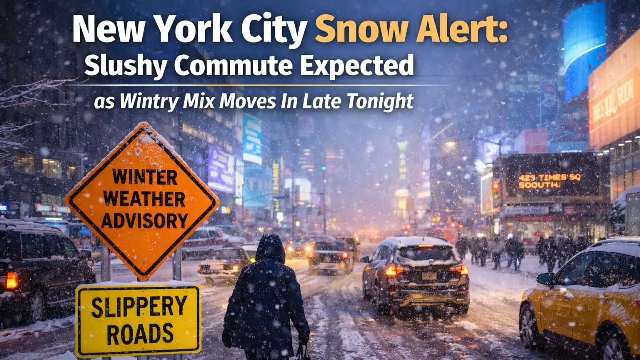
by New York City, New York — Residents across New York City should prepare for a messy and potentially slippery Tuesday morning commute as accumulating snow and a wintry mix move into the region late tonight and continue into early Tuesday. While snowfall totals in the city are expected to remain modest, timing during peak travel hours could significantly impact roads, bridges, and public transportation.
According to the National Weather Service office in New York, snow will begin overnight and intensify toward the pre-dawn hours, before transitioning to rain later Tuesday morning or around midday.
Snow Expected Overnight Into Early Tuesday
Forecasters say 1 to 2 inches of snow are expected across much of New York City before warmer air changes precipitation to rain. Snowfall rates will be highest late tonight through early Tuesday, allowing snow and slush to accumulate on roadways just as commuters head out.
Even lighter snowfall amounts could lead to hazardous travel conditions, particularly on untreated surfaces, bridges, and elevated roadways where temperatures remain colder.
Officials caution that while snow totals may seem minor, timing is the primary concern.
Heavier Snow North and West of the City
Snow totals are expected to increase north and west of the city, where colder air will hold on longer. Parts of the Lower Hudson Valley could see 2 to 3 inches of snow, with localized higher totals possible.
Forecast highlights include:
- Up to 3.4 inches near Middletown
- Around 2 inches in Cold Spring
- Approximately 2 inches in Danbury
These areas are more likely to remain snow-covered into the late morning hours, increasing the risk for slippery conditions on secondary roads and hills.
Connecticut and Long Island Impacts
Northern Fairfield County, Connecticut, is expected to receive 1 to 1.5 inches of snow, while coastal Connecticut and Long Island should see less than 1 inch due to warmer surface temperatures and quicker changeover to rain.
While accumulations will be lighter closer to the coast, forecasters warn that brief bursts of snow overnight could still create slick spots before rain washes them away later in the morning.
Winter Weather Advisory in Effect
A Winter Weather Advisory is in effect from 4 a.m. to 4 p.m. Tuesday for several areas surrounding New York City, including:
- Orange, Putnam, Rockland, and northern Westchester counties in New York
- Passaic and western Bergen counties in New Jersey
- Northern Fairfield County in Connecticut
These regions face the highest risk for accumulating snow, slushy roads, and reduced visibility during the morning hours.
Tuesday Morning Commute Most Impacted
Meteorologists stress that Tuesday morning will be the most affected period, especially between early morning and mid-morning. Snow-covered and slushy roads may slow traffic, while reduced visibility could lead to delays across highways and local streets.
A faster transition to rain would limit snowfall totals, while a slower changeover could allow slightly higher inland accumulations. Regardless of the exact totals, officials say commuters should expect difficult travel conditions early Tuesday.
What Drivers and Commuters Should Expect
Transportation officials urge drivers to plan ahead and allow extra time. Recommended precautions include:
- Reducing speed and increasing following distance
- Using caution on bridges and overpasses, which freeze first
- Watching for slushy buildup during heavier snowfall rates
- Monitoring transit updates for delays or schedule changes
Pedestrians should also use caution on sidewalks and steps, as slush may refreeze in shaded areas early in the day.
Read Also: Christmas Storm Still on Track to Soak Southern California as Heaviest Rain Nears
Conditions Improve by Tuesday Afternoon
As temperatures rise and rain becomes dominant, conditions are expected to improve gradually through the afternoon. Snow and slush should melt quickly in the city, though standing water and residual slick spots could linger briefly.
Officials emphasize that while this is not expected to be a major snowstorm, timing and road conditions could still pose challenges for commuters across the region.
Are you seeing snow or slippery roads where you live? Let us know how conditions look in your area by sharing in the comments below.