 by
by Seattle, WA — A strong Pacific storm system swept across Western Washington over the past day, delivering widespread heavy rainfall and setting new precipitation benchmarks in parts of the region, according to the National Weather Service in Seattle.
Powerful Storm Brings Widespread Heavy Rain
The 24-hour rainfall period, which ended at 10 p.m. PST Thursday, produced some of the heaviest totals of the season. Meteorologists reported that 4 to 6 inches of rain fell across the Cascade Mountains, while parts of the Olympic Mountains recorded nearly 7 inches, highlighting the intensity of the system.
Forecasters described the event as “a widespread, high-impact rainfall event with significant totals across the higher terrain,” noting that rapid runoff could lead to downstream effects in rivers and creeks.
Olympic Mountains and Cascades See Highest Totals
The most intense precipitation focused on the windward slopes of the Olympic Peninsula, where moisture-rich air was forced upward by the terrain. The Cascades followed closely behind with prolonged, steady rainfall that saturated soils across higher elevations.
In contrast, areas under the Olympic rain shadow—including parts of the central Puget Sound and the Seattle metro—saw significantly lower rainfall totals, underscoring how geography shaped the storm’s impact.
Record Rainfall Reported in Bellingham
One of the most notable outcomes of the storm was a new daily rainfall record in Bellingham. While final verification is still underway, the National Weather Service confirmed that the record reflects “the strength and reach of this system as it moved inland.”
The milestone adds to an already active fall pattern across Northwest Washington, where repeated systems have produced above-average rainfall in recent weeks.
Rising Rivers and Flood Risk
Hydrologists are closely monitoring river levels following the heavy rain. Particular attention is focused on the Skokomish River basin, which is known to respond quickly during intense rain events and has a history of flooding.
Officials warn that “river levels could rise rapidly,” especially in flood-prone areas, with localized flooding possible in low-lying zones, near rural creek crossings, and along roads where water may accumulate.
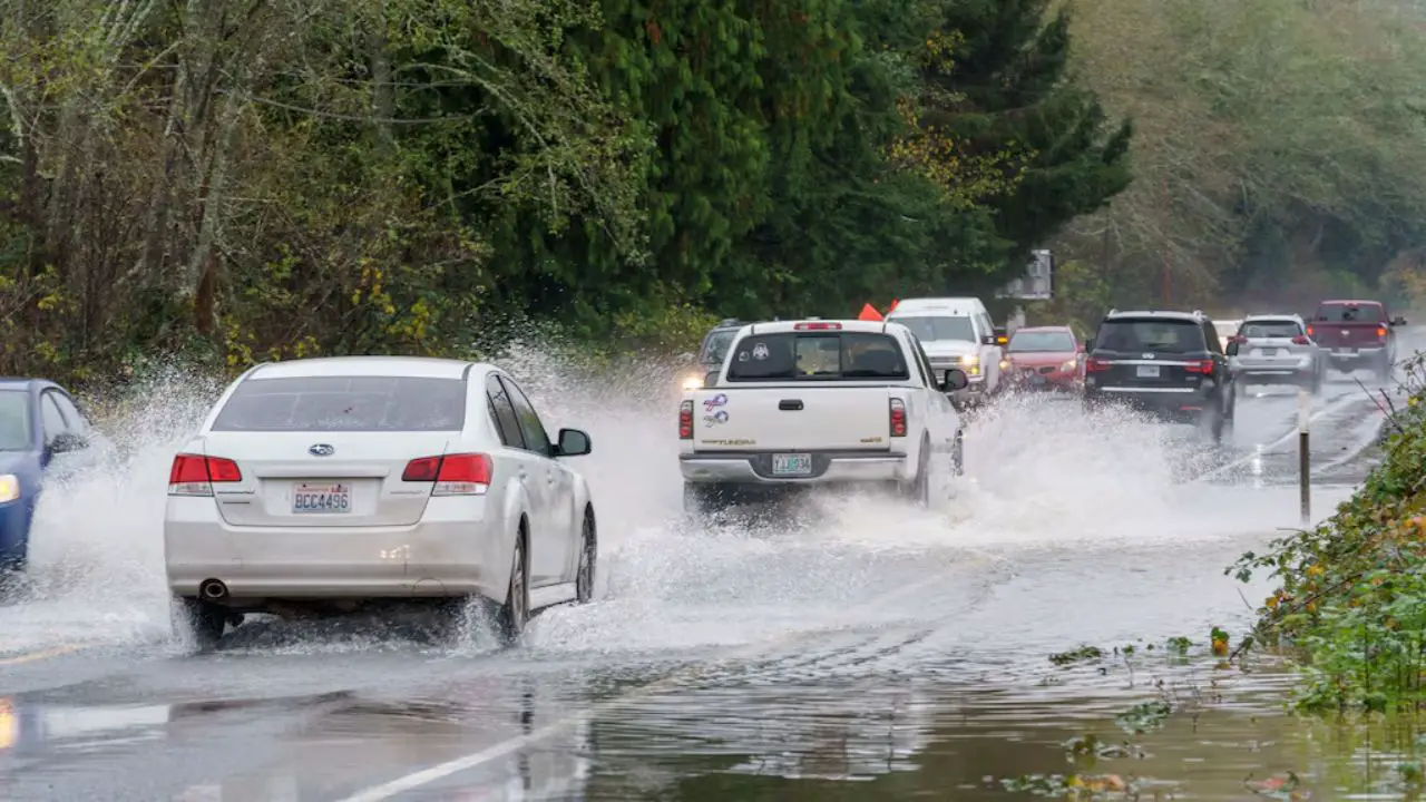
Travel Impacts Across the Region
Transportation officials urge caution for drivers throughout Western Washington. Saturated roadways, reduced visibility, and isolated debris may create hazardous travel conditions, especially in mountain areas.
Even locations that received lighter rainfall are advised to remain alert, as “standing water and rapidly changing conditions” can still pose risks during overnight and early-morning travel.
What Residents Should Keep in Mind
Authorities recommend that residents remain weather-aware in the days ahead. Monitoring updated flood advisories, avoiding driving through standing water, and allowing extra travel time are strongly encouraged. With soils already saturated, additional rain could quickly worsen conditions.
Conclusion
While the heaviest rain has moved east, Western Washington is still feeling the effects of a powerful Pacific storm that delivered significant rainfall, set records, and raised concerns about flooding and travel safety. Forecasters continue to watch river responses closely as the region recovers from this high-impact weather event.
Share Your Experience
Have you noticed flooding, high water, or travel disruptions where you live? Let us know what conditions were like in your area by sharing your experience in the comments.