 by
by Sioux Falls, SD — South Dakota residents are being urged to prepare for a dangerous blast of Arctic air that could bring frostbite-level cold to the state during Thanksgiving week.
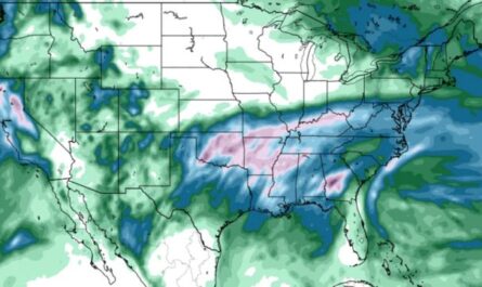
New projections from the National Oceanic and Atmospheric Administration (NOAA) show a powerful temperature drop beginning November 25, with conditions likely to deteriorate through early December.
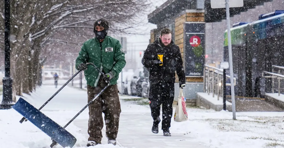
The forecast raises concern for holiday travelers, hunters, and anyone spending extended time outdoors as wind chills plunge well below freezing.
NOAA Warns of a Major Late-November Pattern Shift
According to NOAA’s Nov. 19 climate outlook, a combination of La Niña, the Madden–Julian Oscillation, and the potential emergence of a rare late-November sudden stratospheric warming event is creating the setup for a sharp and prolonged cold outbreak. These large-scale atmospheric patterns may send a surge of Arctic air sweeping across the Northern Plains, placing South Dakota squarely in the zone for below-normal temperatures.
NOAA meteorologists say this shift could mean one of the coldest Thanksgiving periods in recent years. Holiday travelers should expect colder-than-average temperatures during peak driving days, while hunters and outdoor workers will face elevated risks due to wind chills capable of creating frostbite in minutes.
“The combination of Arctic air, increasing winds, and prolonged outdoor exposure can be dangerous,” NOAA cautioned in its update. “Residents should take extra care to limit exposure and dress appropriately.”
Increased Frostbite Risk Across Outdoor Activities
With thousands of South Dakotans preparing for traditional late-November hunting weekends, early winter sports, and holiday events, state health officials are warning that frostbite and hypothermia can develop quickly in such conditions.
Frostbite occurs when skin and underlying tissues freeze, usually affecting fingers, toes, ears, cheeks, and nose. Even brief exposure can cause damage during periods of severe wind chill, and the risk increases significantly for children, older adults, and those without adequate winter clothing.
Read Also: Health Alert: L.A. County Issues Countywide Beach Water Advisory After Heavy Rain
Key Frostbite Symptoms to Watch For
Health experts urge residents to monitor themselves and others for signs of early frostbite. Common symptoms include:
- Numbness or loss of feeling
- Tingling or prickling sensations
- Cold, hard, waxy-looking skin
- Skin discoloration (red, white, blue, gray, or purple)
- Blisters that may appear after rewarming
If untreated, frostbite can lead to permanent nerve damage or even amputation. Quick action can reduce severity.
Hypothermia Concerns Rise as Arctic Air Advances
While frostbite affects exposed skin, hypothermia impacts the entire body. It happens when core body temperature drops below 95°F — a life-threatening emergency that can escalate quickly.
Ten Critical Signs of Hypothermia
Officials highlighted the most important symptoms to recognize:
- Shivering
- Slurred speech
- Shallow breathing
- Weak pulse
- Confusion
- Memory loss
- Severe fatigue
- Stumbling or lack of coordination
- Drowsiness
- Loss of consciousness
Infants may show bright red, cold skin and unusually low energy, which requires immediate intervention.
Safety Guidance for the Holiday Week
NOAA and state health authorities are urging South Dakotans to prepare now, especially those planning to spend time outdoors during Thanksgiving celebrations. Hunters should pack extra warming layers, check wind chill forecasts frequently, and avoid solo excursions. Families traveling across the state should keep emergency winter kits in their vehicles, including blankets, warm clothing, food, water, and portable chargers.
Medical officials recommend taking extra precautions during peak cold hours — typically overnight and early morning — when wind chills are most severe. Anyone showing symptoms of frostbite or hypothermia should seek medical attention immediately and begin warming affected areas using warm (not hot) water or gentle body heat. Abrupt heating can worsen damage.
What Comes Next for South Dakota Weather
Meteorologists say the cold surge could linger into the first week of December, depending on the strength of the Arctic air mass and evolving atmospheric patterns. Additional snow chances may develop as the colder air settles in, though snowfall totals remain uncertain. Residents can monitor updates through the NOAA Climate Prediction Center and local National Weather Service offices.
For more in-depth weather updates, community reporting, and ongoing coverage of cold-weather impacts across the region, visit mikeandjonpodcast.com.