 by
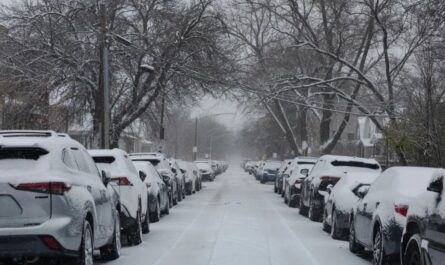
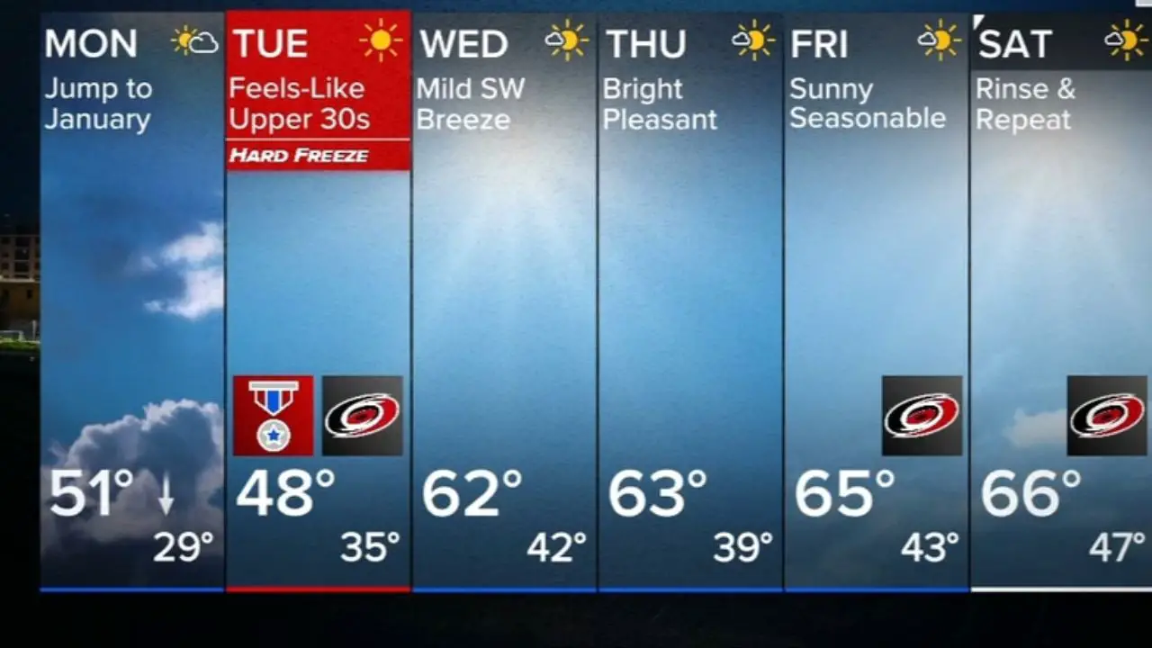
by Raleigh, North Carolina – Central North Carolina is bracing for a strong cold front that will bring isolated storms, gusty winds, and a hard freeze lasting through early Tuesday, according to the National Weather Service in Raleigh. Residents across the Raleigh-Durham region are being urged to prepare for rapidly falling temperatures and freezing conditions overnight.
Storms to Sweep the Region Tonight
Meteorologists have issued a Level 1 (Marginal) Risk for severe weather this evening, with the greatest threat between 7 p.m. and midnight. The storms could produce localized damaging winds and small hail, especially along the I-40 and I-85 corridors.
“A few strong storms are possible ahead of the front, but the main story will be the dramatic temperature drop that follows,” — National Weather Service, Raleigh
Once the front moves through, temperatures will fall sharply, setting up one of the coldest nights of the season so far.
Freeze Warning and Frigid Wind Chills
The Freeze Warning will remain in effect from late Monday night through Tuesday morning, as temperatures plunge into the mid-20s across much of the Triangle. Wind chills could make it feel as cold as the upper teens, especially in open and rural areas.
Officials are advising residents to take precautions:
- Protect pipes by letting faucets drip overnight.
- Bring pets indoors and cover sensitive plants.
- Avoid leaving outdoor hoses connected to prevent freezing damage.
Gusty north winds of 20–30 mph will make Monday night feel especially harsh before gradually easing on Tuesday.
Light Rain or Flurries Possible Before Clearing
As the front exits, a brief burst of light rain or snow flurries could develop late Monday night, mainly in northern counties. Accumulation isn’t expected, but roads may become briefly slick in elevated or shaded areas.
By Tuesday afternoon, skies will clear and sunshine will return, though highs will only reach the low 40s — about 15 degrees below average for early November.
Milder Weather Midweek
Forecasters expect temperatures to rebound by Wednesday, with highs climbing back into the 50s and lows staying above freezing. The warmer trend is likely to continue through the end of the week.
The National Weather Service emphasizes that while this cold snap is brief, it marks the first major freeze event of the season for much of the region.
How are you preparing for the early freeze across North Carolina? Share your tips and experiences in the comments on mikeandjonpodcast.com.